Showing posts with label June2013. Show all posts

Thursday, June 06, 2013

The Ute Cemetery

ute-cemetery 1
Cemetery fence, quite near the Wheeler Ditch Trail.
Restoration of the cemetery was completed around 10 years ago.

ute-cemetery 2
Soldier's graves with similar government-issue headstones all sent from the East in 1890.

ute-cemetery 3
"J.B.Meginity: U.S.Soldier."
Meginity was a Civil War Veteran who came to Aspen to work in a silver mine.
He died in an avalanche on March 11, 1884.

ute-cemetery 5
Many graves and family plots have surrounding fences: this is one of the most elaborate

ute-cemetery 6
Grave of Jacqueline Penz, March 22, 1897-September 8, 1897

Wednesday, June 05, 2013

The Wheeler Ditch

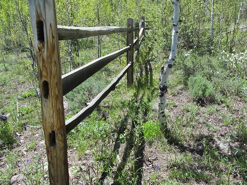
Not far from our condo is a trail that goes behind a number of very elegant homes:
wheeler-ditch 7
Trail Head
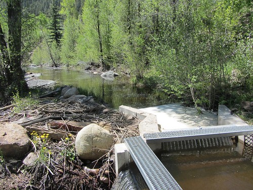
After a while the trail goes down a slope to the banks of the river and the "ditch" or channel that diverts some of the water flow.

As I understand it, the Wheeler Ditch was originally part of the original copper-mining operations of the 19th century town of Aspen, long before skiing, physics meetings, the music festival, and the Aspen Institute. Now the ditch is put to another use: controlling water flow on the Roaring Fork River to facilitate irrigation of the farms and ranches in the valley downstream from here. The Colorado Water Trust and public input play a role in determining how the water will be used.

The water-control channels and mechanisms:
wheeler-ditch 2
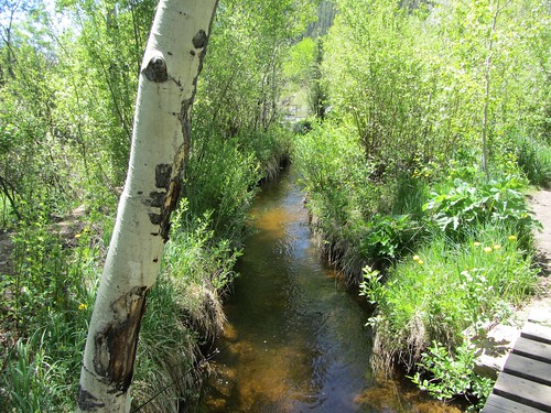
The ditch runs parallel to the river
wheeler-ditch 3
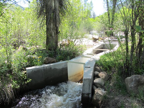
Just beyond the water gate
wheeler-ditch 4
Sluice Gates
wheeler-ditch 5

At the end of the trail is a city park and a very old cemetery from the 19th century. Though bikes aren't allowed alongside the ditch where the trail is very narrow, both ends of the trail connect to very nice bike paths as well as to the Ute Trail that goes much higher up Aspen Mountain.

Tuesday, June 04, 2013

Pink House, Pink tree


Most of the buildings in Aspen are new and expensively opulent, with occasional older Victorian-style houses or mansions that look as if they have been extensively remodeled. They have gardens to match: one often sees groups of gardeners working to groom the shrubs and flowers.

A few older and more modest homes still stand here and there. I noticed today this house, painted the same shade of pink as the tree that was blooming in its modest yard. Another similar one stands next to it, painted a pale yellow; I wonder if that matches the fall colors of an aspen tree in its yard.

Sunday, June 02, 2013

Hiking up to the Maroon Bells

Maroon Lake Hike to Crater Lake
At Crater Lake with our hiking companions Sean and Mo.
Last time we hiked up this trail was with Elaine and Larry in 2011 -- a week ago, we just stayed at Maroon Lake.
It's as spectacular as ever!
maroon-bells0909
Maroon Lake as seen from the trail towards Crater Lake
maroon-bells0887
Crater Lake -- a skier had walked to the top of a snowy area and skied down.
Crater Lake is at around 10,000 feet.
maroon-bells0906
On the trail
maroon-bells5288
Up high, the aspen trees are just starting to leaf out 


Saturday, June 01, 2013

Outdoor sculpture, miles long

glenwood-canyon 2
Engineering Marvel! A highway and a trail.
Highway 70 from Glenwood Springs up through Glenwood Canyon is like a huge and magnificently engineered sculpture set into the riverbed of the rushing Colorado River. Construction began in the 1970s, and took 20 years, according to the placards at the Grizzly Creek Rest Area. Special equipment was imported from France where it had been invented for building highways in the Alps; local engineering firms invented some additional new devices for building a highway in the river bed. The goal was to minimize disruption of the natural beauty. I think the whole project created its own type of beauty. I love this type of functional art!

glenwood-canyon 4
The Trail
Below the highway just above the water is a paved trail that allows one to take a magnificent bike ride or a stroll. We drove to the No Name Rest Stop on the highway which also allows access to the No Name Trailhead. From there we followed the giant sculpture up to Hanging Lake, where there is another rest stop and trailhead. It was so popular that there were no spaces for cars when we arrived there.

glenwood-canyon 7
Hanging Lake above the dam, viewed from the Rest Area.

glenwood-canyon 9
Just below Hanging Lake -- the dam that forms the lake is visible just above Len's shoulder.

glenwood-canyon 10
The Highway disappearing into a tunnel just before Hanging Lake

glenwood-canyon 11
Reward: lunch at No Name Rest Area at the end of the ride.

For more photos, click on any of these and you will see my Flickr set. Addendum:
glenwood-canyon12
Me, taking photos on the trail